Top 10 Hikes I've Been On
written by: Abby Jong
If I were to describe my experience with COVID-19 in one word- self-discovery. During quarantine, everyone around me seemed to be trying new activities, finding new hobbies, and discovering new talents.
Me? I started hiking more.
Here is the list of hikes I’ve been on since quarantine, ranked by personal favorites and opinions.
**photo credits to my iPhone and Google Images**
10. Hill of Life (Austin Greenbelt)
This hike is honestly the hardest hike I’ve been on in Austin. It’s 3.1 miles out and back and has an elevation gain of 328 feet. It doesn’t seem terrible, but all of the elevation changes in the first fourth of the hike made me question how aerobically fit I was. There are great views all along the way and it’s always a fun time, no matter how out of breath I am. If you want a challenging hike about 15 minutes from campus, this one is for you.
9. Sculpture Falls (Austin Greenbelt)
Sculpture falls is always a solid hike to hit on the Greenbelt in Austin. It’s a 3.2 mile trail with a 124 foot elevation gain and opens up to small waterfalls where you can wade or swim in. This hike usually has water flowing, or at least the times that I’ve gone, and can be a nice spot to sit and read in a hammock. The water is refreshing to dip your feet in and the scenery is quite peaceful. If you want a quick hike to a chill spot to hang out, this is the one.
8. Lost Creek Trail (Austin Greenbelt)
After walking up and down the river and failing to find the entrance to the trail, a nice lady pointed it out to me and my friends and we were off! The flat trail is about 1.2 miles and follows the river before opening out to small waterfalls where you can sit, relax, or swim. There’s also a rope swing you can hike to further down the river, but the rocks under the tree where the rope is attached make it a bit dangerous, so just be careful and swing all the way out before letting go.
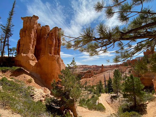
7. Figure 8 Combination Loop (Bryce Canyon National Park)
Bryce Canyon is known for its Hoodoo formations which are made from wind and ice erosion. This hike combines Queen’s Garden trail, Peek-a-Boo Loop, and Navajo Trail into one 6.4 mile trip. It’s filled with ups and downs, some of them more mental than physical, but there are some great rock formations along the whole hike. I went in August, which I would not recommend because it was so hot and dry during the day and a bit chilly at night, and the powerful sun would make it hard to look up at the rock formations without sunglasses. If you’re up for a challenging and dusty hike, this one's for you.
6. The Narrows (Zion National Park)
This hike can actually be quite dangerous if you’re one of those die-hard backpackers who do the most with their hiking and camp overnight. I just did a casual hike down the river starting from the visitor center. The further you go down the river, the less crowded it gets as most people tend to quit after taking a quick picture so the hike can be as long or as short as you want it to be. I went about three to four miles in before turning around, but the canyon views are amazing and the chacos I packed came in clutch for comfort on the journey. It’s definitely helpful to use a hiking stick on this hike because it’s quite slippery and you can’t always see your feet. The Narrows is a must-see when visiting Zion, go further in to get better views and better photos.
5. Santa Elena Canyon (Big Bend National Park)
This hike was probably one of the funniest hikes I’ve ever been on just because of the situation I found myself in (I’ll tell you the whole story if you ask me in person). The whole trail follows the US bank of the Rio Grande and you can get to it by taking the Santa Elena Scenic drive. The whole hike is relatively short, 1.4 miles with an elevation gain of 160 feet, but it has great spots to sit by the river and some cool rocks to climb along the way. There also were lots of cute mountain goats on the other side of the river that you can hear bleating throughout the canyon. The river is usually shallow and there are parts you can cross, but the mud at the bed of the river is pretty sticky and sludgy so cross at your own risk! This is a nice hike to get some high quality scenery if you’re feeling particularly low on energy.
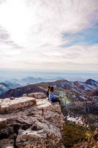
4. Emory Peak (Big Bend National Park)
Let me just preface this one by saying that this one was definitely a hike to remember. My friends and I not only got lost and hiked an extra 3 miles trying to find our way back to the visitor center parking lot, we had to do it in the snow and in the dark after doing the whole 15.2 mile hike (2466 feet of elevation gain) of South Rim to Emory Peak. This one definitely tests your relationships because of how exhausting it was, but will most definitely give you a rewarding view at the top and some amazing stories to tell afterwards. The last section is called the scramble where you’re half climbing, half hiking to the top and a nice change of pace from the inclines and switchbacks. I don’t know if I would ever do this hike again, but the views, the memories, and the experience will be forever cherished.
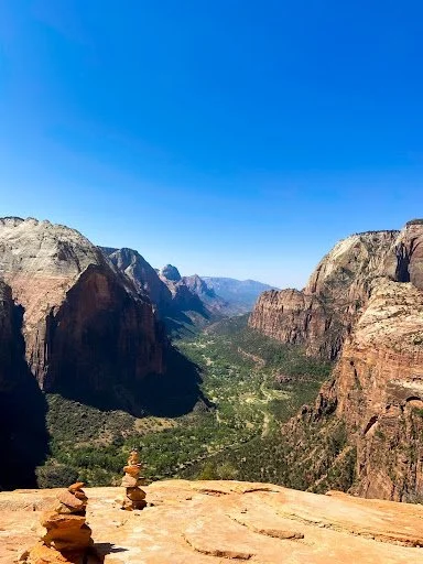
3. Angel’s Landing (Zion National Park)
Angel’s landing was by far the most risky hike I’ve been on. The last section of the hike is on a ridge, making it extremely scary if you’re afraid of heights. There is a chain railing that you can hold onto as you ascend to the top, but 14 people have died in the past 21 years so be cautious while going up. The view was definitely worth it, especially if you find a less crowded area. The whole hike is about 2.4 miles one way with an elevation gain of 1500 feet. As one of the more popular hikes at Zion National Park, be prepared for lots of uphill walking and climbing with lots of people.
2. Lost Mine Trail (Big Bend National Park)
The big takeaway I have for this hike is that... Mountain. Naps. Hit. Different. I went after it snowed in West Texas, making the weather a lot cooler. Taking a nap at the top of the hike in 50 degree weather with the sun shining directly over me as a natural blanket was honestly the best feeling ever. The actual hike itself had a lot of switchbacks and was 4.2 miles total with an elevation gain of 1100 feet, a perfect day hike. Having a packed lunch to eat while enjoying the view really topped it off and I would say this hike hit all the right spots in difficulty, length, and scenery.
1. Mohawk Lake (White River National Forest)
Mohawk Lake actually consists of an upper and a lower lake. To get to both, you can just start at Spruce Creek Trail and go all the way up the mountain. The whole hike was about 8.4 miles round trip with a 2106 foot elevation gain, and it felt like we went through all four seasons throughout the duration of the hike. It started with a nice Colorado warm summer and ended with a cold Texas winter; we actually saw snow at the upper lake! This hike flew by in some sections and others needed some extra time dedicated to resting while enjoying the view. I would recommend doing this hike if you’re in the Breckenridge area and would 100% do it again.
Honorable mentions
1. Mount Bonnell
I think Mount Bonnell is a place where everyone visiting Austin has to go to at least once. It has great sunset views over Lake Austin. It’s not too draining to get to the spot, just a couple hundred steps up to the top of the hill. My favorite thing to do while watching the sunset here is to sit and look at the nice lake-front houses. I’ve seen so many sunsets here and it’s always a beautiful sight every time I go.
2.360 Bridge
This spot, in my opinion, has better views for sunrises, but it’s still a nice view for sunset. This is more of an uphill climb than Mount Bonnell and you might need to use your hands a little bit, but it’s shorter in distance. The view overlooks the Pennybacker bridge and you can often see boats going back and forth on Lake Austin. There’s actually a hiking trail further down the overlook if you explore past the fence. 360 is also a must-see when visiting Austin
Key takeaways from my year of hiking: hydrate, don’t diedrate! And wear lots of sunscreen!


